Countries I've visited map: show my world on one poster
The fastest way to get a map of the countries you have visited onto your wall: mark them online, download a print-quality file, print it in any size.
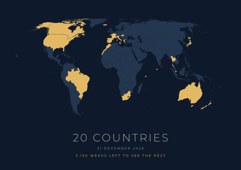
Make your visited countries map in three steps
- Mark the countries. In the Show My Earth map maker, click each country you have been to or search it by name. 237 countries and territories are available.
- Choose a design. Five designs, from a light paper look to a dark navy and gold one. The poster shows your number of countries and a date.
- Download and print. For $3 you get a vector PDF, a 7016 px PNG and an SVG. Send it to any print service or print it at home.
It takes about five minutes, and it needs no account and no app.
Ways to show the countries you have visited
| Option | Typical cost | Good | Limits |
|---|---|---|---|
| Printable map maker (Show My Earth) | $3 plus printing | Your choice of design, size and paper. Small countries stay visible. A new map after every trip costs little. | You arrange the printing yourself. |
| Scratch-off map | About $15 to $40 | Arrives ready to hang. Scratching is fun. | One design and size. Tiny countries are hard to scratch. Mistakes cannot be undone. |
| Pin board map | About $40 to $150 | Marks cities and places, not only countries. | Large and expensive. Pins fall out. |
| Travel tracking app | Free to a few dollars | Always with you. Good statistics. | Lives on a phone, not on a wall. Exports are often low resolution. |
Prices are typical ranges and vary by seller.
What counts as a visited country?
There is no official rule, so pick one and stay consistent. The common ones:
- Feet on the ground outside the airport. The most used rule. A layover where you never left the terminal does not count.
- At least one night. Stricter. Day trips and border hops are out.
- Did something there. A meal, a walk, a sight. The rule many frequent travellers use.
Territories are the other question. Show My Earth lets you mark places such as Greenland, Hong Kong, Puerto Rico and the Faroe Islands separately, so the count on your poster can be higher than a count limited to the 195 countries.
Printing tips
- Use the PDF. It is a vector file, so it is sharp at every size.
- A matte paper of 170 to 250 g/m² looks best for flat colour maps.
- Pick the poster shape that matches your frame: A sizes, 3:2 or 4:3. Details are in the print size guide.
Questions and answers
How do I make a map of the countries I have visited?
Open showmyearth.com, click the countries you have visited, choose a design and download the map. Previewing is free; the print-quality PDF, PNG and SVG cost $3.
Is there a free visited countries map?
You can make and view your map on Show My Earth for free, with a watermark and simplified coastlines. The high-resolution files without watermark cost $3, a one-time payment.
Can I update the map after my next trip?
Yes. Your selection stays saved in your browser. Add the new country and download a new map; each download is a separate $3 purchase.
Can I add the weeks I have left to travel?
Yes. Enter your birth date and the poster shows how many weeks you have left to see the rest of the world, counted to age 100. See the weeks left calculator.
Does it work on a phone?
Yes. On a phone the country list with search is the easiest way to mark countries, and tapping the map works too.